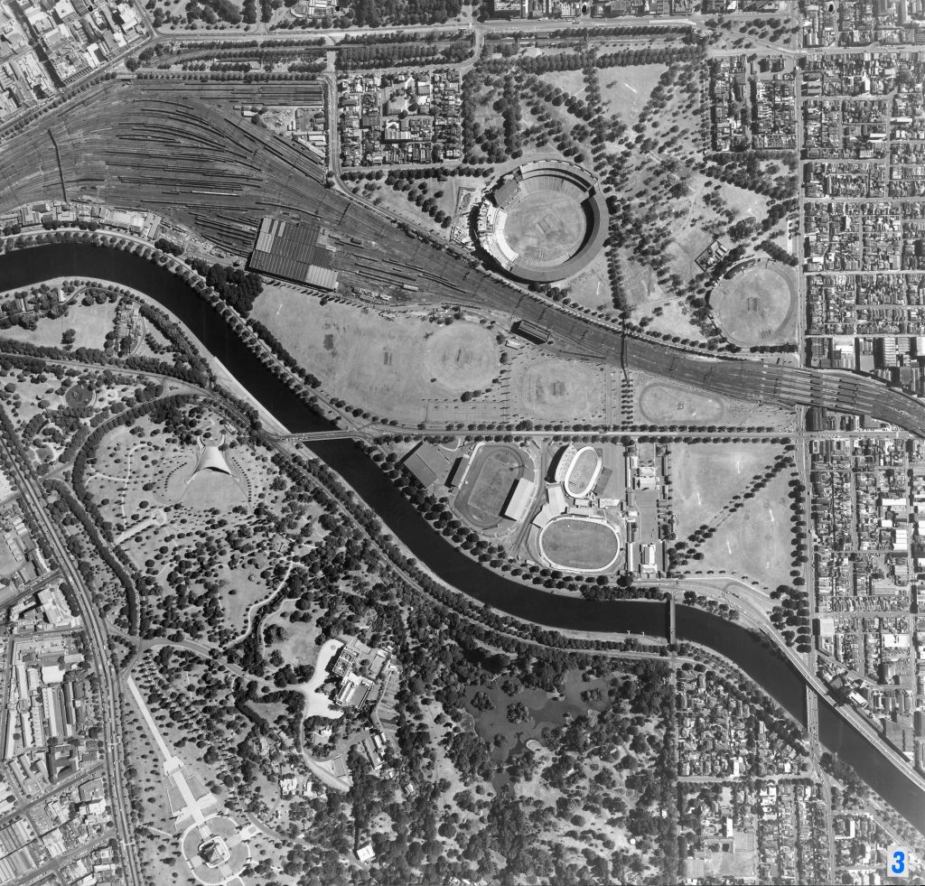
Image 3 – Aerial view of the Yarra River, King’s Domain, Melbourne Sports and Entertainment Precinct 1967
Maker unknown
Registration number
1897008
Artist/maker
Maker unknown
Title
Image 3 – Aerial view of the Yarra River, King’s Domain, Melbourne Sports and Entertainment Precinct
Production date
1967
Medium
photograph on paper on linen, metal
Dimensions (H x W x D)
92 x 96 cm
Inscriptions
3
Credit line
City of Melbourne Art and Heritage Collection
Keywords
Summary
This aerial photograph is part of a collection of large format images stored in a wooden cabinet. The photographs document the Melbourne City Council municipality, particularly focusing on the areas west, north-west and south of Melbourne CBD. These areas have undergone huge urban transformation in the time since these photographs have been taken.
The Yarra River is central to this map. There are a number of bridges visible, including Swan Street Bridge (centre), Morell Bridge (lower centre) and Hoddle Bridge (lower right), as well as Richmond Train Station (centre right). On the southern side of the Yarra key landmarks include St Kilda Road (left), the Sidney Myer Music Bowl (centre left), the Shrine of Remembrance (lower left), Government House (lower centre), the Ornamental Lake in the Royal Botanical Gardens (lower centre). Visible on the northern side of the Yarra are a number of Olympic stadiums which were demolished (Olympic Park Stadium, Olympic Park No. 2 (greyhound racing track), Olympic Park Velodrome). This is where the Melbourne and Olympic Park precinct is now located. The Olympic Pool Stadium is visible and remains in this location today. The Melbourne Cricket Ground (upper centre) and Punt Road Oval (upper right) are also visible in the north.