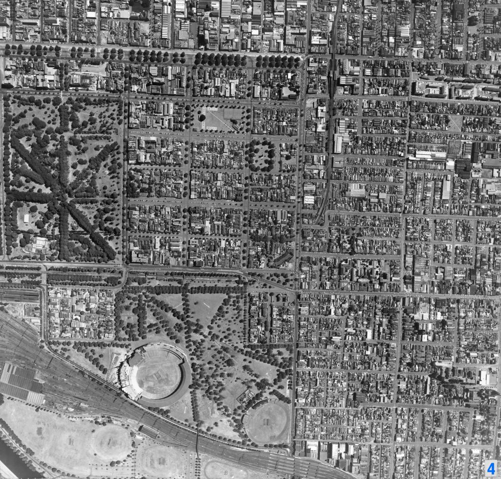
Image 4 – Aerial view of East Melbourne and Richmond 1967
Maker unknown
Registration number
1897009
Artist/maker
Maker unknown
Title
Image 4 – Aerial view of East Melbourne and Richmond
Production date
1967
Medium
photograph on paper on linen, metal
Dimensions (H x W x D)
92 x 96 cm
Inscriptions
4
Credit line
City of Melbourne Art and Heritage Collection
Keywords
Summary
This aerial photograph is part of a collection of large format images stored in a wooden cabinet. The photographs document the Melbourne City Council municipality, particularly focusing on the areas west, north-west and south of Melbourne CBD. These areas have undergone huge urban transformation in the time since these photographs have been taken.
This map captures East Melbourne (left) and Richmond (right). It features the Melbourne Cricket Ground (lower left), Richmond Station (lower centre), Fitzroy Gardens (centre left), Powlett Reserve (upper centre), West Richmond Station (centre) and North Richmond Station (upper centre).