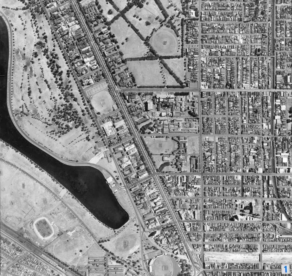
Image 1 – Aerial view of Albert Park, South Yarra, St Kilda Junction 1967
Maker unknown
Registration number
1897006
Artist/maker
Maker unknown
Title
Image 1 – Aerial view of Albert Park, South Yarra, St Kilda Junction
Production date
1967
Medium
photograph on paper on linen, metal
Dimensions (H x W x D)
96 x 92 cm
Inscriptions
1
Credit line
City of Melbourne Art and Heritage Collection
Keywords
Summary
This aerial photograph is part of a collection of large format images stored in a wooden cabinet. The photographs document the Melbourne City Council municipality, particularly focusing on the areas west, north-west and south of Melbourne CBD. These areas have undergone huge urban transformation in the time since these photographs have been taken.
This photograph captures the parks south of the city. Albert Park is located on the left. The Albert Park Barracks (demolished 1979) are visible on the southwest corner of Albert Park (lower left). Junction Oval (lower middle) and Middle Park Stadium (lower left) are also visible. Also documented is St Kilda Junction during the construction of Queens Way, which opened on 11 December 1968 (lower right).