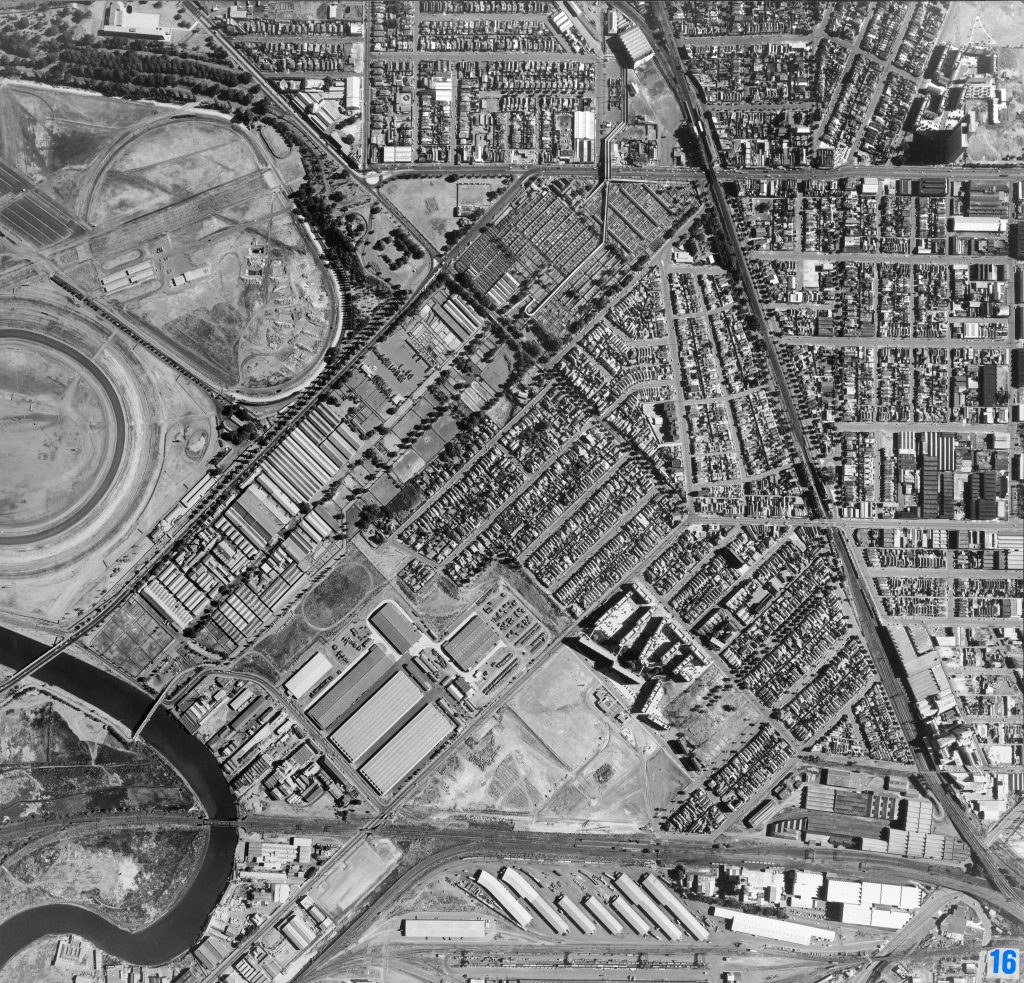
Image 16 – Aerial view of Kensington and Flemington 1967
Maker unknown
Registration number
1897223
Artist/maker
Maker unknown
Title
Image 16 – Aerial view of Kensington and Flemington
Production date
1967
Medium
photograph on paper on linen, metal
Dimensions (H x W x D)
92 x 96 cm
Inscriptions
16
Credit line
City of Melbourne Art and Heritage Collection
Keywords
Summary
This aerial photograph is part of a collection of large format images stored in a wooden cabinet. The photographs document the Melbourne City Council municipality, particularly focusing on the areas west, north-west and south of Melbourne CBD. These areas have undergone huge urban transformation in the time since these photographs have been taken.
This photograph documents the areas of Kensington and Flemington. In the top centre of the photograph, The Newmarket Saleyards are visible. The Newmarket Saleyards were first established in 1861 on the periphery of Melbourne city. The saleyards operated for more than a century on the corner of Smithfield Road and Racecourse Road until they were closed in 1987 and transformed into a housing estate called the Lynch’s Bridge Project. This photograph also features Flemington Racecourse (upper left), the Maribyrnong River (lower left), the Housing Commission of Victoria's Holland Estate towers (lower right).