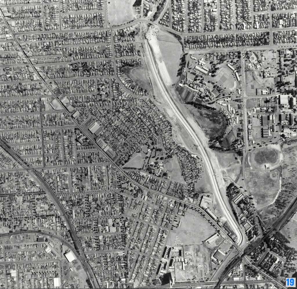
Image 19 – Aerial view of Flemington, Travancore and Ascot Vale 1967
Maker unknown
Registration number
1897555
Artist/maker
Maker unknown
Title
Image 19 – Aerial view of Flemington, Travancore and Ascot Vale
Production date
1967
Medium
photograph on paper on linen, metal
Dimensions (H x W x D)
92 x 96 cm
Inscriptions
19
Credit line
City of Melbourne Art and Heritage Collection
Keywords
Summary
This aerial photograph is part of a collection of large format images stored in a wooden cabinet. The photographs document the Melbourne City Council municipality, particularly focusing on the areas west, north-west and south of Melbourne CBD. These areas have undergone huge urban transformation in the time since these photographs have been taken.
This photograph captures the development of Housing Commission of Victoria's Debney Meadows Estate in Flemington (lower right). The site, known as Debney's Paddock, was predominantly owned by the City of Melbourne and had been earmarked for development as public parkland. A 15-hectare site did become parkland, today known as Debneys Park, and 2 hectares was used for the Estate. In this photograph, the first 20-storey tower has been completed (1965). Another 3 towers would be built shortly after. To the right of the Estate is Flemington Bridge railway station, and the Upfield railway line (lower right). Moonee Ponds Creek runs down the right-hand side of the photograph, prior to the construction of the Citylink tollway. Mt Alexander Road runs diagonally across the image. The Craigieburn train line is visible on the left-hand side of the image, as well as the Flemington Racecourse train line (lower left).