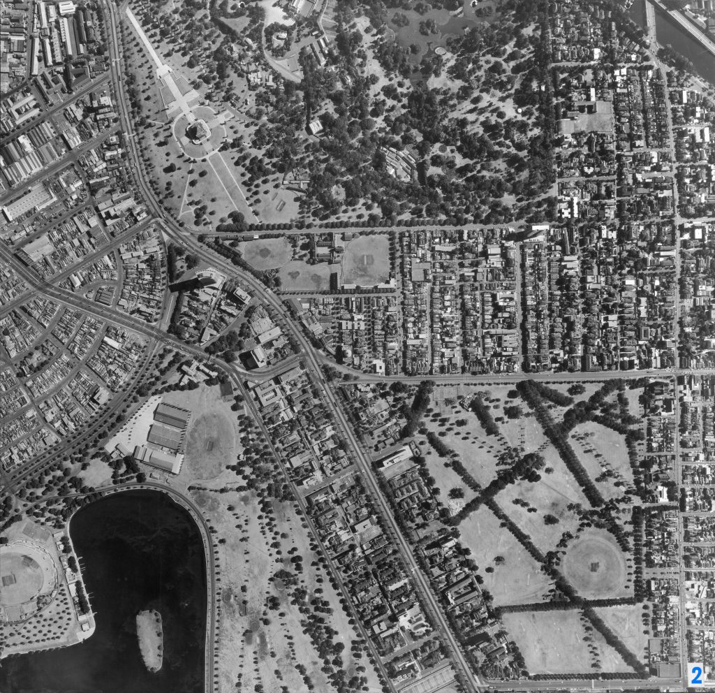
Image 2 – Aerial view of Albert Park, St Kilda Road, South Yarra 1967
Maker unknown
Registration number
1897007
Artist/maker
Maker unknown
Title
Image 2 – Aerial view of Albert Park, St Kilda Road, South Yarra
Production date
1967
Medium
photograph on paper on linen, metal
Dimensions (H x W x D)
92 x 96 cm
Credit line
City of Melbourne Art and Heritage Collection
Keywords
Summary
This aerial photograph is part of a collection of large format images stored in a wooden cabinet. The photographs document the Melbourne City Council municipality, particularly focusing on the areas west, north-west and south of Melbourne CBD. These areas have undergone huge urban transformation in the time since these photographs have been taken.
St Kilda Road runs down the middle of this photograph. Many of the old stately mansions that used to line St Kilda Road and Queens Road are still visible before they were demolished. Along St Kilda Road we can see the Shrine of Remembrance (upper left), the then recently opened arc shaped BP House (upper left) and Melbourne Grammar School (upper left). The northern corner of Albert Park is captured (lower left), featuring the MacRobertson Girls' High School. Fawkner Park (lower right) is also visible, as well as the Royal Botanical Gardens (upper middle).