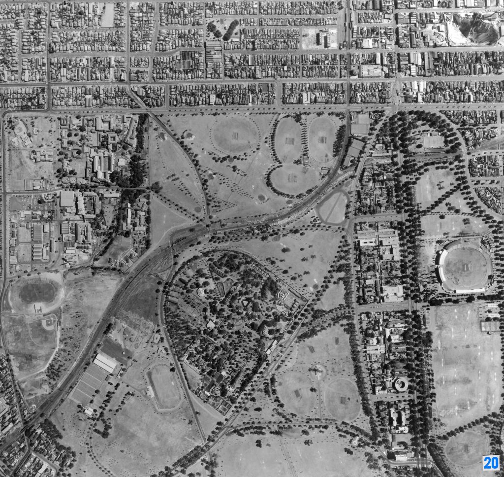
Image 20 – Aerial view of Royal Park, Parkville and Princes Park 1967
Maker unknown
Registration number
1897556
Artist/maker
Maker unknown
Title
Image 20 – Aerial view of Royal Park, Parkville and Princes Park
Production date
1967
Medium
photograph on paper on linen, metal
Dimensions (H x W x D)
92 x 96 cm
Inscriptions
20
Credit line
City of Melbourne Art and Heritage Collection
Keywords
Summary
This aerial photograph is part of a collection of large format images stored in a wooden cabinet. The photographs document the Melbourne City Council municipality, particularly focusing on the areas west, north-west and south of Melbourne CBD. These areas have undergone huge urban transformation in the time since these photographs have been taken.
This photograph captures the area of Royal Park and Parkville. The Melbourne Zoo is visible in the centre of Royal Park, surrounded by a number of ovals and fields. The Royal Melbourne Hospital is visible in the upper left corner. Princes Park is located on the right-hand side of the image, as well as the Monash University Parkville Campus (centre right). Visible in the upper right corner is a quarry, the former site of a large-scale brickworks, clay pits and tile and brick manufacturing operating for 100 years from the 1860s to the late 1960s. The claypits were filled in, and this area is now occupied by the Barkly Square shopping centre.