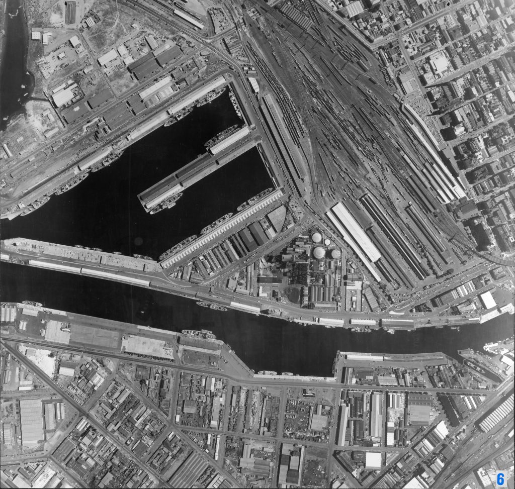
Image 6 – Aerial view of Docklands 1967
Maker unknown
Registration number
1897204
Artist/maker
Maker unknown
Title
Image 6 – Aerial view of Docklands
Production date
1967
Medium
photograph on paper on linen, metal
Dimensions (H x W x D)
92 x 96 cm
Inscriptions
6
Credit line
City of Melbourne Art and Heritage Collection
Keywords
Summary
This aerial photograph is part of a collection of large format images stored in a wooden cabinet. The photographs document the Melbourne City Council municipality, particularly focusing on the areas west, north-west and south of Melbourne CBD. These areas have undergone huge urban transformation in the time since these photographs have been taken.
This photograph documents the area of Docklands as an industrial area and port, prior to its redevelopment in the 1990s. Central to this photograph is Victoria Dock (upper left), and the Spencer Street Station railway which had recently been renovated (upper right). The dock is historically significant as the main port facility through which general cargo was shipped and handled for Victoria from 1924 to 1970. The growth of containerised cargo saw Swanson Dock being constructed in the 1970s, gradually rendering Victoria Dock redundant. During the 1980s, Docklands fell into disuse and disrepair. Since then, the post-industrial redevelopment of Docklands for residential, commercial, retail and leisure use has seen dramatic change in the area.