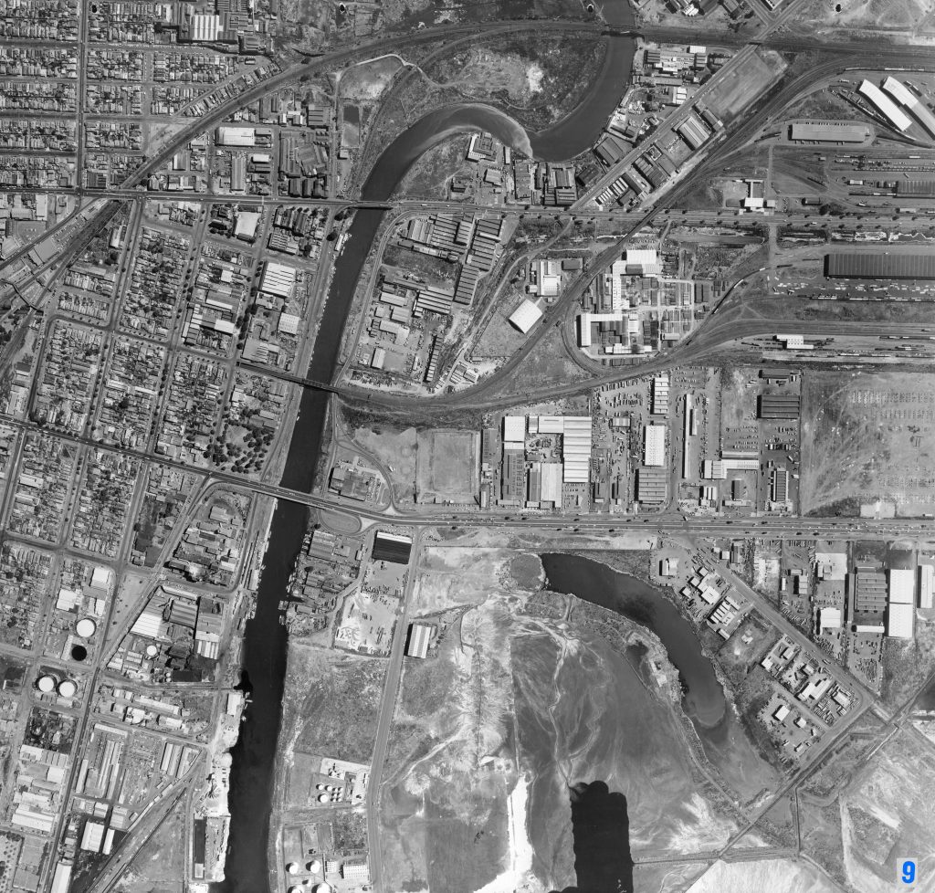
Image 9 – Aerial view of Maribyrnong River, Coode Island, West Melbourne and Footscray 1967
Maker unknown
Registration number
1897205
Artist/maker
Maker unknown
Title
Image 9 – Aerial view of Maribyrnong River, Coode Island, West Melbourne and Footscray
Production date
1967
Medium
photograph on paper on linen, metal
Dimensions (H x W x D)
92 x 96 cm
Inscriptions
9
Credit line
City of Melbourne Art and Heritage Collection
Keywords
Summary
This aerial photograph is part of a collection of large format images stored in a wooden cabinet. The photographs document the Melbourne City Council municipality, particularly focusing on the areas west, north-west and south of Melbourne CBD. These areas have undergone huge urban transformation in the time since these photographs have been taken.
This photograph documents the area of West Melbourne and Footscray. The Maribyrnong River is central to the image, with a number of crossing points visible including Kensington Rail Bridge (upper right), the old Hopetoun Bridge (upper left), Bunbury Street Railway Bridge (centre left) and Shepherd Bridge (centre left). This photograph captures the development of Swanson Dock, which began construction in 1966.